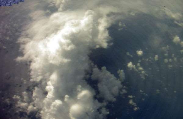


Global Hawks were built for the still skies above wars. The surveillance drones, America's largest, fly in the calmer altitudes of around 60,000 feet above the ground, where they can wait for over a day, cameras pointed down, watching. The same characteristics that make a Global Hawk a useful tool of war against insurgents also lend its power as a storm watcher. NASA has a Global Hawk, painted bright white and not Air Force gray — and last week it flew over a tropical storm Gaston, determining it was, in fact, a hurricane.
The Global Hawk was flown in support of NOAA's National Weather Service National Hurricane Center. From NOAA:
The key data was collected by a dropsonde, a small instrument dropped from an aircraft that measures tropical storm conditions as it descends to the surface of the ocean. The dropsonde then transmits the data to a satellite which relays it in real time to the National Hurricane Center.
The Global Hawk took this important data from the 75th dropsonde out of 84 dropped from the plane during a 24-hour flight. The National Hurricane Center evaluated the data to upgrade Gaston to be the third hurricane of the season at 12:15 AM ET on Thursday. The data indicated that Gaston had strengthened to a hurricane with wind speeds estimated to be 75 miles per hour. In its latest report Thursday afternoon, the National Hurricane Center downgraded Gaston to a tropical storm, but noted the storm in the Central Atlantic 1160 miles east-northeast of the Leeward Islands could intensify on Saturday
Gaston may still just be a tropical storm now, but thanks to the drone flight overhead, for a brief moment scientists knew the truth of Gaston: that it was the hurricane it aspired to be, and that it may retain enough strength to become a hurricane again.
Check out the picture of the hurricane from above, captured by the Global Hawk:


EDITOR'S PICKS


